![]()
Brays Island Interactive Property Map
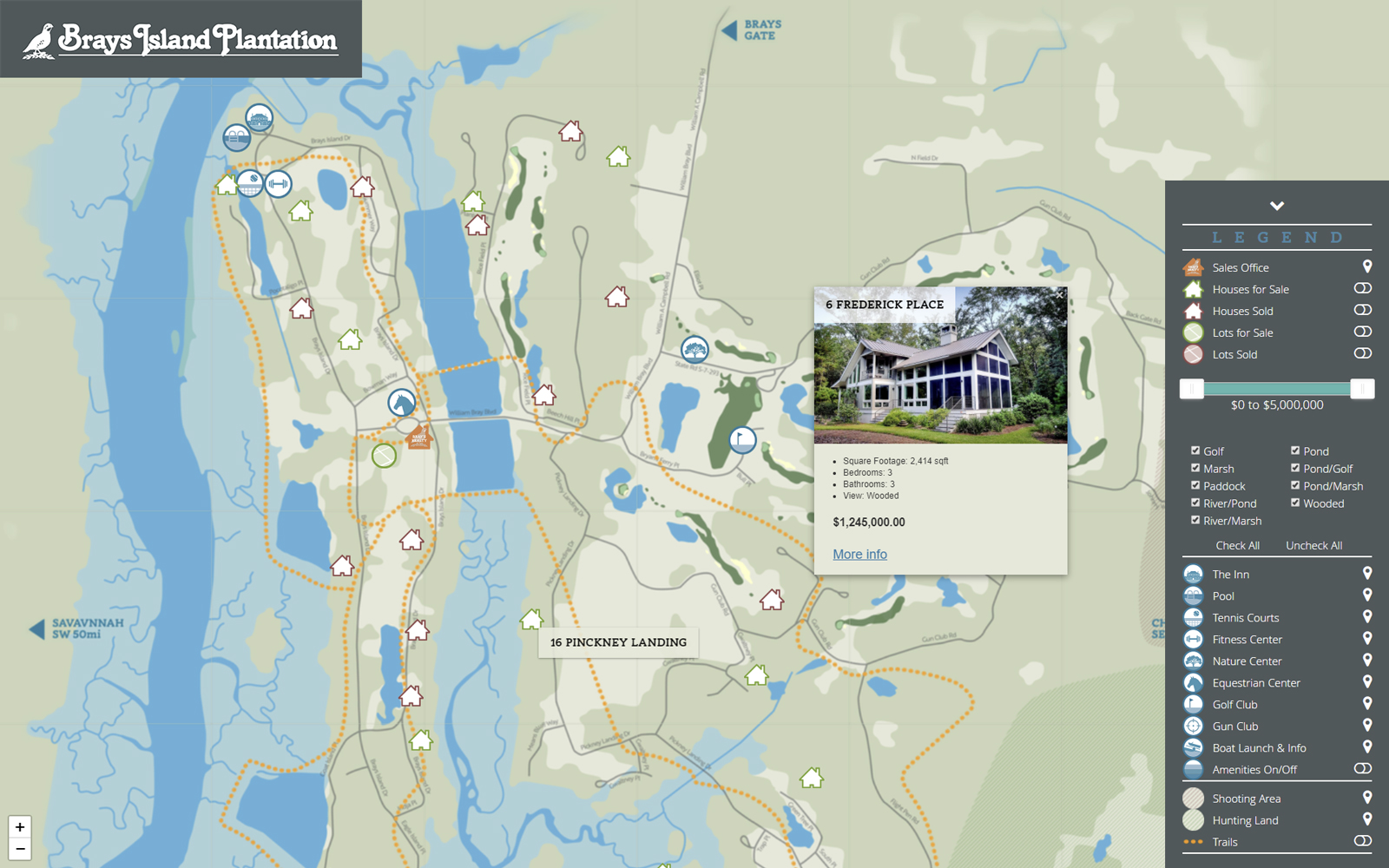
Design and development of an interactive property map for Brays Island Plantation. The base map was built in vector format to allow large format printing as well as allow for a crisp looking interactive map at high levels of zoom.
The legend allows for quick filtering by property type, price, or view, as well as turning on/off different visual elements. It also serves as navigation for the amenities and pans to the clicked amenity in the legend.
Properties and amenities are dynamically loaded from a few JSON files, allowing a great level of flexibility when updating.
Similar functionality single property maps were created for each individual home, homesite, and amenity.


